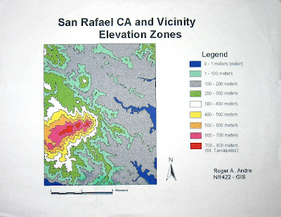
It's funny how things come full circle sometimes. When I graduated from college, my final GIS project was a map of elevation zones surrounding Mt. Tamalpaias in Marin, CA. The big deal about that project was the chance to use the Sun UNIX workstations that were ordinarily only accessible to graduate students and faculty. Those machines had the full version of ArcInfo needed to work with raster data sets, unlike the PC ArcInfo version which we had in the NR labs. As I recall, in order to complete the project, I had to download the correct USGS DEM, run a bunch of RECLASS commands to create elevation zones, convert the reclassified GRID into polygons, and finally bring it all into ArcView 3.x to make a map. I must have been pretty proud of the final result, because I saved the single printout I made of the map for almost 10 years. Recently, I've begun to work with elevation DEM's again, and among other things, have been using them to represent elevation and surface relief in maps. The ideas are similar to those used in that NR422 project, but the tools are completely different. So while I was happy to make something that looked like this in 1999:
It actually is a pretty lame map, so let's see if we can make something now that looks more like this beautiful map from Encyclopedia Brittanica

Let's start with making a hillshade.
